Is the Perito Moreno Glacier Still Advancing?
No. Perito Moreno held near-equilibrium for around eighty years, but measurements published in 2025 show frontal thinning accelerating from 0.34 to 5.5 metres a year after 2019, with unprecedented retreat. Many tour listings still say otherwise.
The claim you will hear
Read almost any brochure, listen to almost any guide, and you will be told that Perito Moreno is one of the very few glaciers on Earth still advancing while the rest retreat. Two of the tour listings here say it in their own itinerary copy.
It was true for most of the twentieth century. It is not true now, and the work that established that is published, peer-reviewed and dated.
Why it stayed stable for so long
Two things held the ice front in place, and both are worth understanding because both are now weakening.
The first is snowfall. Perito Moreno drains the Southern Patagonian Ice Field, roughly 13,000 square kilometres of ice fed by Pacific weather systems that dump enormous quantities of snow on its western flank. For decades that accumulation replaced what melted at the terminus.
The second is the bed. The front grounded against a submerged rocky ridge. A grounded glacier loses ice slowly, because the ridge takes its weight and resists retreat. A glacier that floats free of its bed loses ice quickly. That ridge is the single most important object in this story and nobody photographs it, because it is underwater.
What the 2025 study found
Research led by Moritz Koch with Pedro Skvarca and Lucas Ruiz, published in Communications Earth & Environment in August 2025, combined helicopter-borne radar, bathymetric survey and satellite time series of surface elevation and velocity.
| Measurement | 2000–2019 | 2019–2024 |
|---|---|---|
| Frontal surface lowering | 0.34 metres per year | 5.5 metres per year |
| Frontal position | Broadly stable | Unprecedented retreat |
| Ice flow | Steady | Accelerating |
That is a sixteen-fold acceleration in thinning. Alongside it the team recorded frontal retreat of roughly 700 metres a year between 2021 and 2023, concentrated on the northern margin. Copernicus satellite imagery from June 2026 shows the ice front well behind its 2016 position.
The part that matters most
The survey mapped the bed beneath the ice and found the front now close to flotation over that protective ridge. The team then modelled what happens if current thinning continues: once the ice recedes past the ridge and begins to float, buoyancy-driven retreat can take over, and that runs much faster than melting alone.
The paper does not name a year, and it is careful about that. Snowfall varies, summers vary, lake conditions vary, and the glacier’s own internal motion varies. What the authors say is that every path they tested points the same way.
Why the old line persists
Because it was true for a long time, because it made an excellent story, and because tourism copy updates slowly. The tale of the glacier that defied climate change sold tickets for forty years, and it is embedded in guidebooks, brochures and the scripts guides learned when they trained.
There is no conspiracy in it. Look at the listings and you will find the same lag on the park entrance fee: the rate changed on 1 June 2026 and almost every booking page still prints the previous figure, as our guide to park fees sets out.
What this changes about a visit
Practically, very little in the short term.
- Calving continues daily and is the thing you actually came to watch.
- Ruptures still occur, on an interval that has never been regular and cannot be booked.
- The walkways, the boat safaris and the ice treks all run as they always have.
- Neighbouring glaciers — Upsala, Viedma — have been retreating for decades and are visible on the same lake.
What changes is what you are looking at. Standing on the central balcony, the wall reads as permanent. Knowing the front has pulled back several hundred metres a year since 2021, and that researchers are watching a submerged ridge to see whether the ice floats clear of it, makes it a process rather than a monument.
Seeing it properly
The walkways give the head-on view and the sound. The boat gives the scale. The ice gives the texture. Which one suits you depends on time, budget and, for the treks, age. The numbers behind each are tabulated on the key facts page, and practicalities on the visitor information page.
How the measurements were taken
The reason this finding carries weight is the method. Glacier fronts are notoriously hard to judge by eye: a terminus can look identical from a viewpoint while losing enormous volume behind it, because thinning happens across the whole surface rather than at the visible edge.
The team combined three things. Helicopter-borne ground-penetrating radar mapped the bed beneath the ice, including the submerged ridge. Bathymetric survey measured the lake floor in front of the terminus. Satellite time series tracked surface elevation and flow velocity year on year. Together those give volume change rather than an impression of position, which is why the acceleration shows up so clearly.
Why thinning matters more than retreat
A glacier that thins loses the weight holding it against its bed. Once the front approaches flotation, the physics change: the ice is no longer grounded, resistance drops, and retreat can accelerate sharply without any further warming. That is the mechanism the model tests, and it is why the ridge matters more than any single year’s frontal position.
What to look for when you visit
- The northern margin — where the measured retreat has been concentrated.
- Brash ice in the channel — calved material collecting in the Canal de los Témpanos.
- The waterline — roughly 170 metres of ice sits below it, against 60 to 74 above.
- Old rupture debris — guides point out where previous arches stood.
The dimensions and the measured figures are tabulated on the key facts page, and the mechanism behind the rupture cycle is explained on the geography page. If you want the human half of the story — the boundary commission, the naming, the man who never saw it — that sits on the history page.
Seeing it from more than one angle
No single vantage point tells you what this glacier is doing. The balconies give the front, the boat gives the scale, and the ice gives the texture and the meltwater. Travellers who did two of the three consistently describe the combination as the thing that made it land, and their accounts are collected on the reviews page. Practicalities for planning that are on the visitor information page, with common questions on the FAQs page.
Book your Perito Moreno Glacier tour
Guided walkway days from El Calafate start at $76, with an optional hour on the water.
Compare Perito Moreno Glacier tours Check AvailabilitySee the ice for yourself — every option is compared at Perito Moreno Glacier Tours, with the hours it buys at the front.
Tours that fit this trip
Chosen to match what this guide covers, not for what sells.
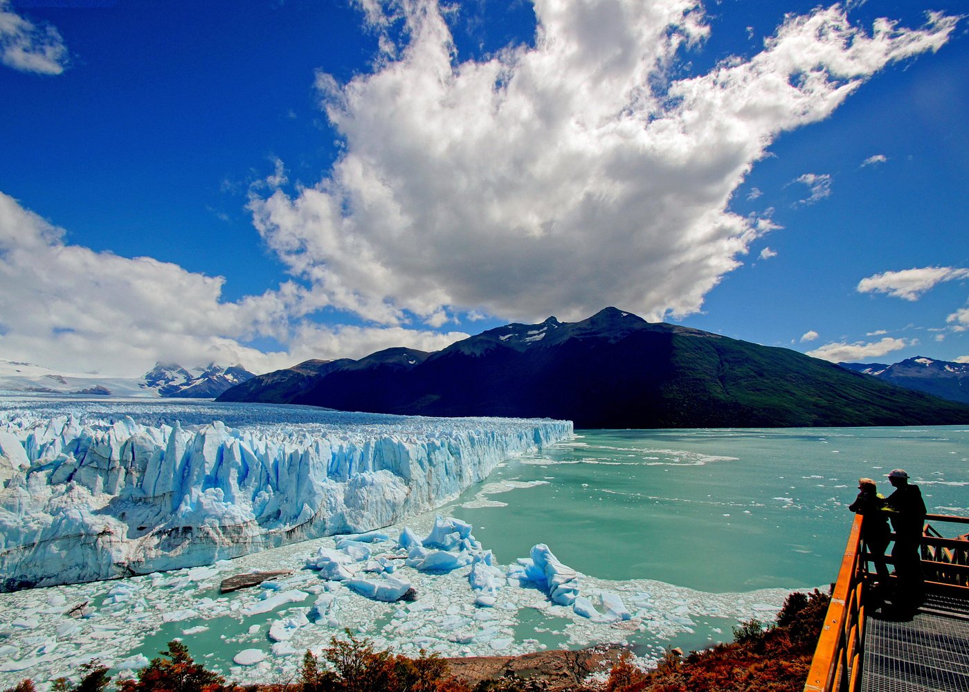
Perito Moreno Glacier Full Day Tour with Optional Boat Safari
The balconies facing the front, which is where the advance and the calving are actually visible.
From $76 per person
Check Availability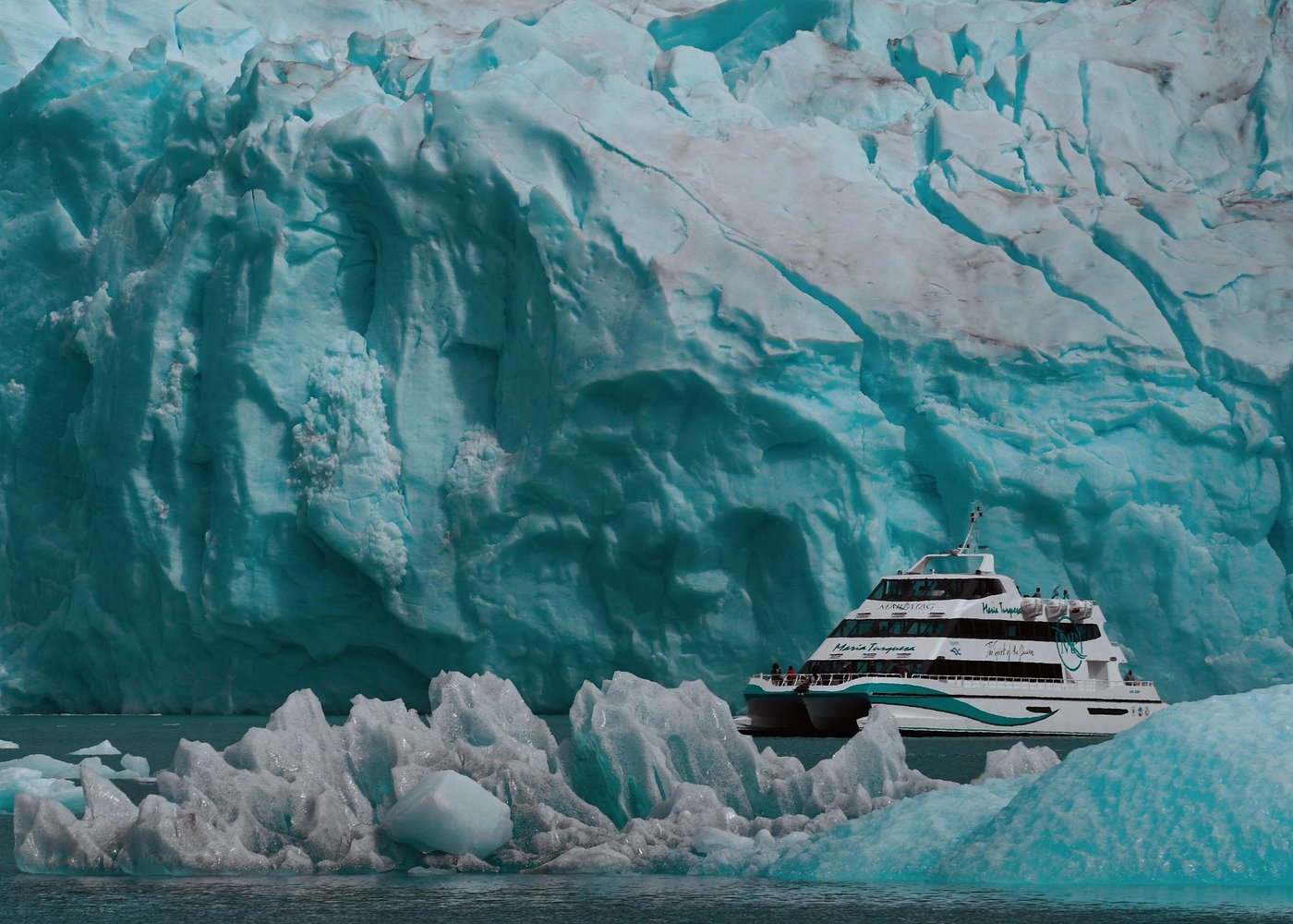
Glaciares Gourmet Navigation: Spegazzini, Upsala & Perito Moreno
Spegazzini and Upsala for contrast — two neighbours behaving very differently from this one.
From $225 per person
Check Availability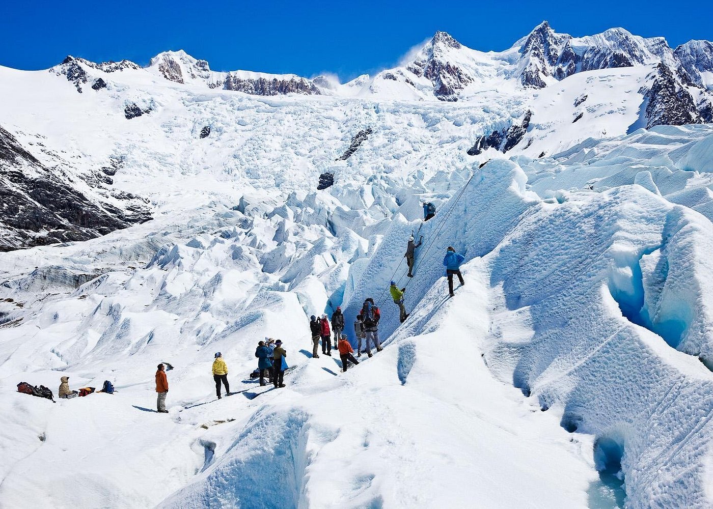
Perito Moreno Full Day Minitrekking with Transfer and Walkways
Minitrekking, for readers who want to stand on the ice they have just read about.
From $440 per person
Check Availability